
Driftwood Member Events
Hiking
Hiking
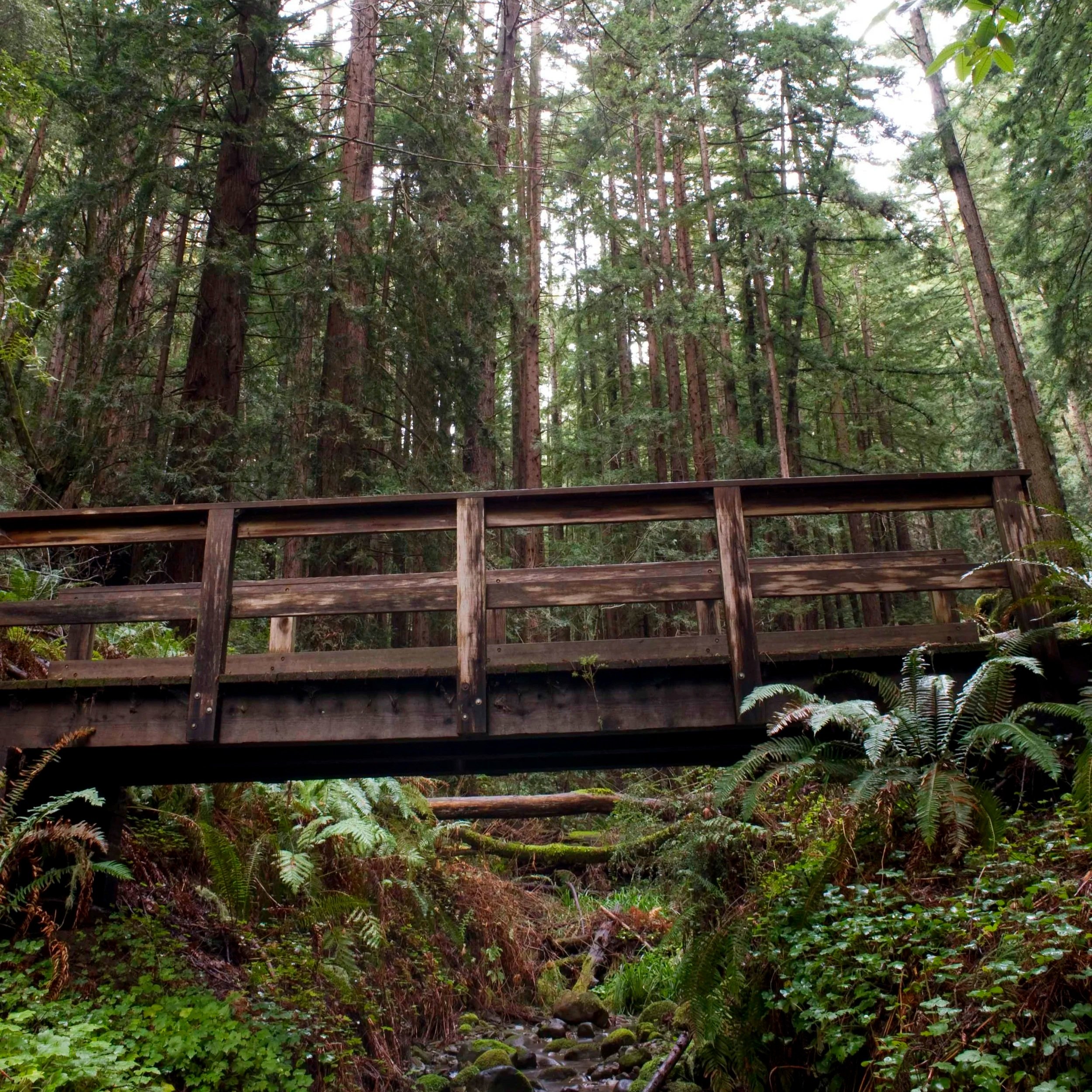
El Corte de Madera Creek
Overview
A scenic eight mile loop through towering redwoods and rolling forested hills, this hike offers peaceful trails and beautiful woodland views. Join us for a relaxed and social way to spend a day outdoors.
Included meal - Turkey and cheese sandwiches with fruit.
Time
The hike will take place January 31st. Meetup will be 8:30 a.m. at Skeggs Point parking lot. We will leave at 9:00 a.m. and return around 3 p.m. to the same location.
Location
Hike starting point and parking location will be at Skeggs Point parking lot.
Address:
15463 CA-35, Redwood City, CA 94062
Coordinates:
37°24'39.2"N 122°18'21.6"W
January 31st
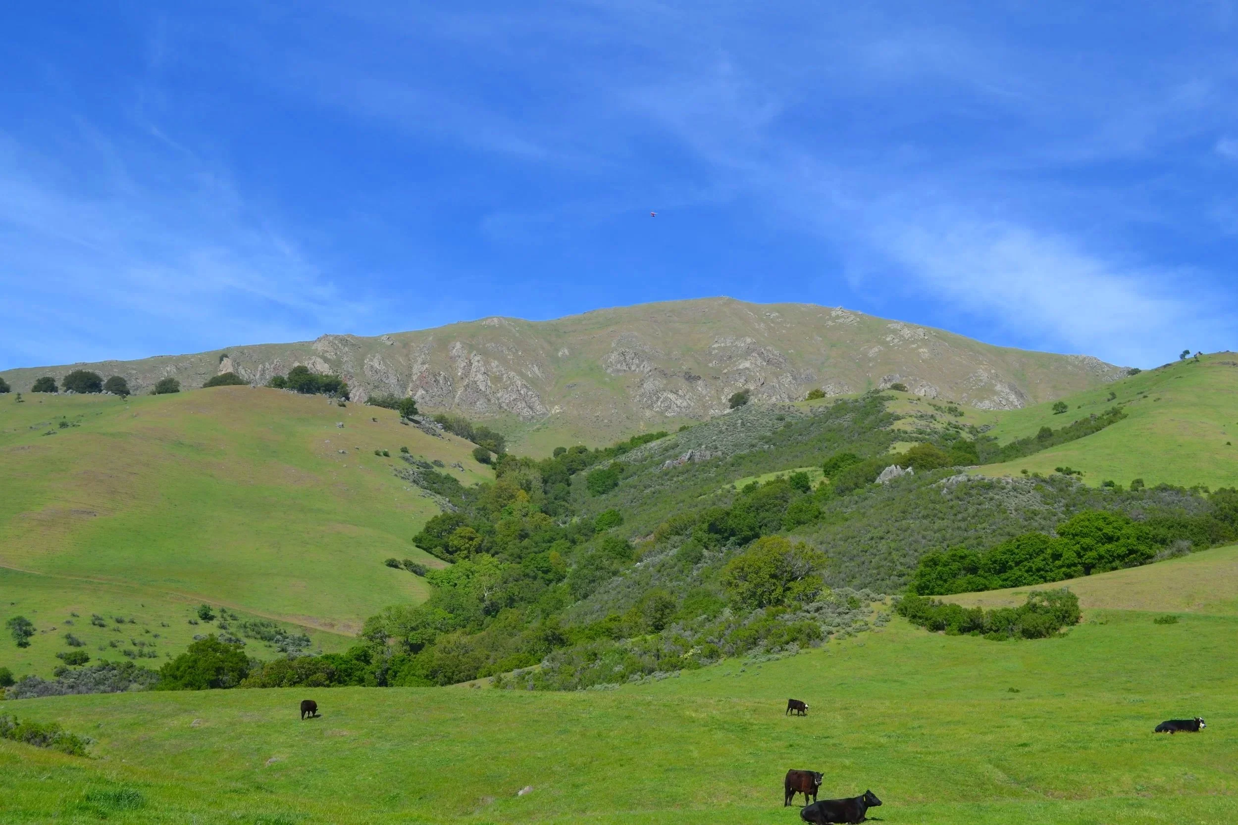
Mission Peak
Overview
A summit hike with wide views across the Bay Area, this trail follows long ridgelines and gentle climbs that reveal beautiful perspectives of the surrounding landscape. The six mile route is designed to feel steady and enjoyable, with time to take in the scenery and connect with the group.
Included meal - Chopped Caesar salad with chicken.
Time
The hike will take place February 14th. Meetup will be 8:30 a.m. at Stanford Avenue Staging Area. We will leave at 9:00 a.m. and return around 3 p.m. to the same location.
Location
Hike starting point and parking location will be at Stanford Avenue Staging Area.
Address:
1997-2099 Stanford Ave, Fremont, CA 94539
Coordinates:
37°30'15.7"N 121°54'30.3"W
February 14th
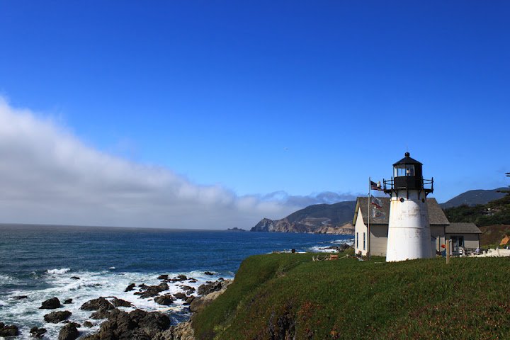
Montara
Overview
A coastal hike with sweeping ocean views and winding hillside trails, this route offers a peaceful and visually rich experience along the shoreline. The trail is approximately six miles round trip, giving plenty of time to enjoy the coastline without feeling rushed.
Included meal - Black bean burrito with guacamole.
Time
The hike will take place February 21st. Meetup will be 8:30 a.m. at Le Conte Trail. We will leave at 9:00 a.m. and return around 1 p.m. to the same location.
Location
Hike starting point and parking location will be at Le Conte Trail.
Address:
Le Conte Trl, Montara, CA 94037
Coordinates:
37°32'40.7"N 122°30'22.5"W
February 21st
Soquel Demonstration
Overview
A peaceful forest hike through breathtaking redwoods and fern lined trails, this route winds through one of the most beautiful woodland areas in the region. The loop is about ten miles long, offering a calm and immersive walk with a mix of shaded paths, gentle terrain, and natural scenery throughout the day.
Included meal - Greek salad with chickpeas.
Time
The hike will take place March 7th. Meetup will be 8:30 a.m. at Soquel Demonstration Trail Head. We will leave at 9:00 a.m. and return around 5 p.m. to the same location.
Location
Hike starting point and parking location will be at Soquel Demonstration Trail Head.
Address:
29400 Highland Way, Los Gatos, CA 95033
Coordinates:
37°04'54.8"N 121°51'02.0"W

March 7th
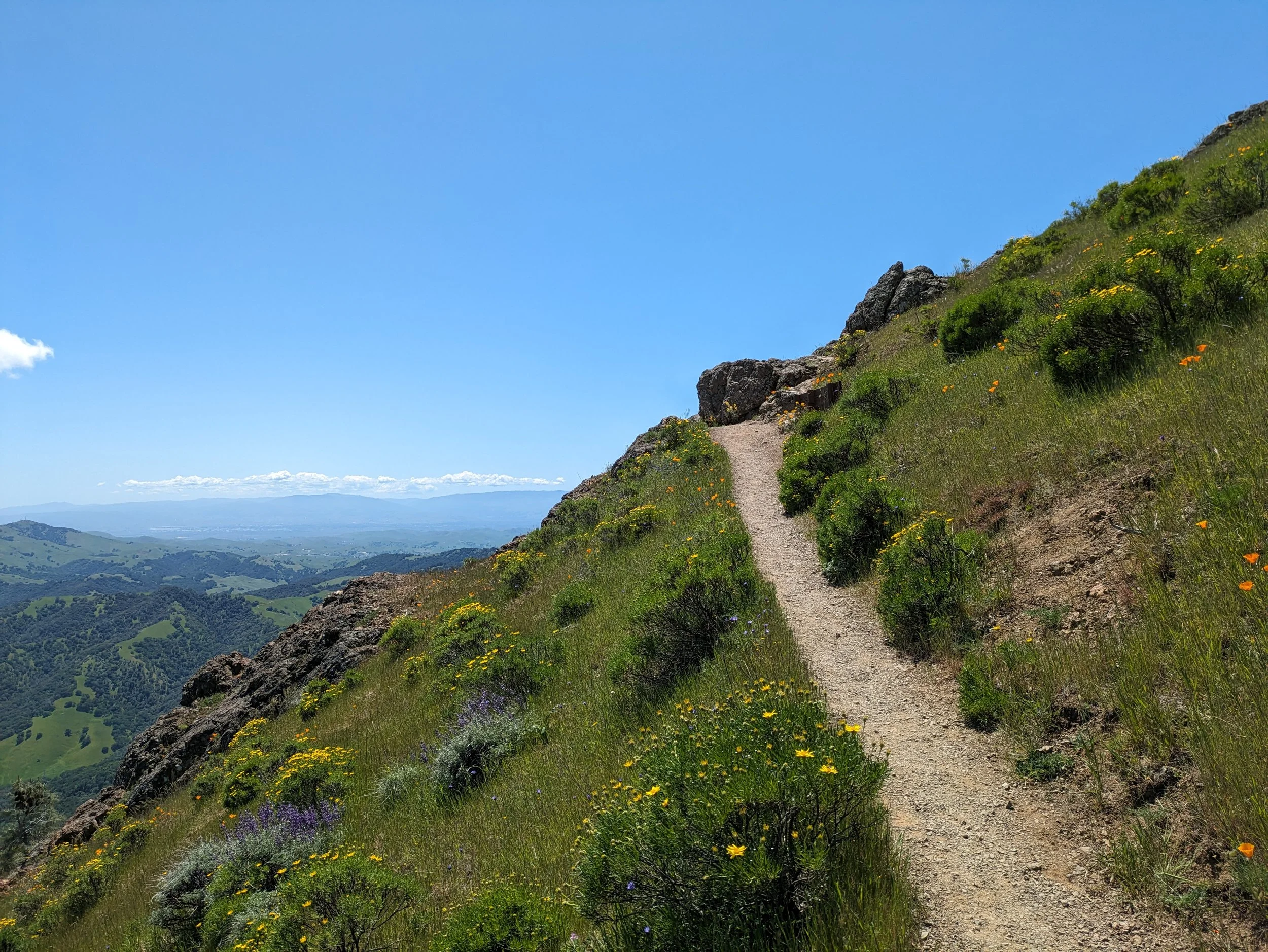
Mount Diablo
Overview
A bright and open hike with some of the best scenery in the East Bay, this Mount Diablo route travels across golden slopes and rugged ridges with beautiful views in every direction. The roughly nine mile loop is ideal for experienced hikers who enjoy longer days on the trail, while still keeping a steady flow that leaves room to take in the landscape and fresh air.
Included meal - Rice bowl with roasted vegetables and grilled chicken.
Time
The hike will take place March 21th. Meetup will be 8:30 a.m. at Mitchell Canyon Parking lot. We will leave at 9:00 a.m. and return around 6 p.m. to the same location.
Location
Hike starting point and parking location will be at Mitchell Canyon Parking lot. You may be required to pay for parking. Bring cash, as card payment may not be possible.
Address:
96 Mitchell Canyon Rd, Clayton, CA 94517
Coordinates:
37°55'14.1"N 121°56'29.5"W
March 21th